Microsoft Flight Simulator Handbook
by Jonathan M. Stern
Enroute Charts
Enroute charts come in two forms—high altitude (18,000 feet to 45,000 feet) and low altitude (LAE) (below 18,000 feet).
Enroute low altitude charts include information found on the charts included in the Flight Simulator Pilot's Handbook (VORs, NDBs, and airports). They also depict Victor airways, the highways in the sky that are used for airplane navigation. Jet routes are the high altitude equivalent of Victor airways. Victor airways and Jet routes are nothing more than VOR radials, Maximum and minimum altitudes are listed, however, to ensure that the airplane is at least 1,000 feet above (2,000 feet in mountainous terrain) the highest terrain or obstacle along the route segment of an airway and at an altitude that allows the airplane to receive the VOR signals necessary for navigation and to communicate with air traffic control.
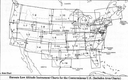
For purposes of flying the Cessna 182RG, this chapter concentrates on LAEs. Exemplar excerpts of LAEs are reprinted in Appendix B. LAEs depict, amongst other things, VORs and VORTACs, Victor airways, airports, localizers, and NDBs. Localizer courses are depicted by a feather where they serve an enroute function (being used to identify an intersection). Appendix A contains the chart legends for both the enroute and the instrument approach procedure charts. The enroute chart legends should be studied with the enroute chart excerpts in Appendix B.
Victor airways are formed by radials from VORs and VORTACs. Generally, east/west airways are assigned even numbers and north/south airways are assigned odd numbers. The dimensions of Victor airways are four nautical miles either side of the centerline (eight nautical miles wide), and wider if the airway extends more than 102 nautical miles between NAVAIDS. Along the Victor airways are intersections, which are denoted by a triangle. Intersections are generally identified by a second VOR or a DME distance. Solid triangles indicate a compulsory reporting point.
IFR aircraft overflying compulsory reporting points in a non-radar environment are required to report to ATC their identification, the name of the reporting point, the time they passed the reporting point, their altitude, their type of flight plan (IFR or VFR), their ETA to the next compulsory reporting point, and the name only of the succeeding compulsory reporting point. Miles between intersections, NAVAIDS, or mileage break points are shown above the route segment.
For each route segment, there is an MEA and an MOCA. The MOCA, or Minimum Obstruction Clearance Altitude, is an altitude that ensures at least 1,000 feet of terrain and obstruction clearance anywhere along the airway. In mountainous Terrain, 2,000 feet of obstruction clearance is provided. The MOCA also ensures reception of the NAVAID that defines the Victor airway within 22 nautical miles of the NAVAID. The MOCA is only for emergency use, and the MEA is the number in which you are most interested.
The MEA, or Minimum Enroute Altitude, ensures the same minimum obstruction clearance as the MOCA and also ensures NAVAID reception and ATC communication reception anywhere along the airway. So, as long as you stay within four nautical miles of the airway centerline and at or above the MEA, you should be able to navigate, communicate, and remain well clear of obstructions.
Virtually every VOR, VOR-DME, and VORTAC in the continental United States is included on the standard database included with Flight Simulator. The transmission distance of a real VOR is often, however, not duplicated on Flight Simulator, so that use of the Victor airways on the charts does not work in all situations. Charted airways that require reception distance greater than 80 nautical miles should be avoided.
In addition to flying on Victor airways, aircraft may be flown on direct routes, between VORs or otherwise. The Federal Aviation Regulations require that the airplane be operated at least 1,000 feet above the highest obstacle within a horizontal distance of five statute miles from the course to be flown. If you know the height of the highest obstacle within five statute miles, you should choose your altitude accordingly if you are flying an off-airway routing.
Table of Contents
Previous Section: Navigation Charts
Next Section: Instrument Approach Procedure Charts