Airienteering with 13MIKE
by Fred J. Calfior and Douglas W. Miller
| APPENDIX B |

Terminal Chart Legend |
A VFR Terminal Area Chart legend is split up into seven sections:
1. Airports
2. Airport Data
3. Radio Aids to Navigation and Communication Boxes
4. Airport Traffic Service and Airspace Information
5. Obstructions
6. Miscellaneous
7. Topographical Information
These will become very important to you as you fly your scenarios within this book. In addition, a mileage scale is provided which is vital for the measuring of distances. There are three possible units of measurement:
1. Nautical miles
2. Statute miles
3. Kilometers
Pilots often use navigation plotters to help measure these distances. You can also use a simple ruler to note the length of the track desired, and measure it out on the mileage scale. A pencil may work, for simplicity sake, though certainly not very accurate! The important concern is only use the Nautical mile scale, since all distances are in nautical miles.
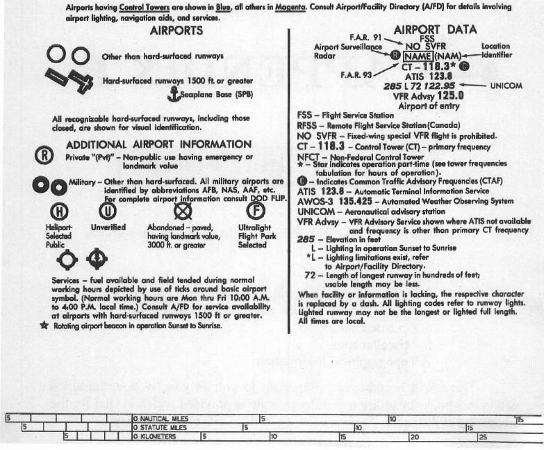
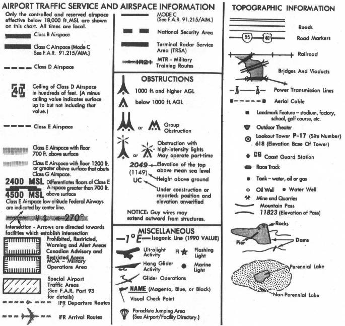
Table of Contents
Previous Section: A3 - New York Terminal Area Chart
Next Section: Other Flights of 13MIKE