IFR Flights of 13MIKE
by Fred J. Calfior and Douglas W. Miller
| Flight Scenario Three |

Kankakee to Champaign |
(Chicago Area - estimated flying time 45 minutes)
Have you had enough of the no-see-ums? Okay, let's do a see-um takeoff with a no-see-um approach. Sound good? Let's do it! We'll depart Greater Kankakee Airport, in the northeast part of Illinois, VFR. We will get a pop up IFR clearance, when the weather starts to close in, and continue the flight under no-see-um rules to Willard-Champaign Airport, in the central east part of Illinois. Before we start, we need to do our flight plan, because we need to give this information to FSS. After we do the flight plan, I'm going to hand you over to Professor Calfior so he can take you through the weather brief and filing of your flight plan. I will step you through the setup phase. That's where we set in those nasty clouds! Professor Calfior will then leap into the right seat (ouch) and assist you through the yuk! Listen to what Professor Calfior has to say about flying techniques. He is not only trying to help you obtain the best possible score but he also has a wealth of information and trivia. Some of his jokes are rather good, if I do say so myself.
Okay, let's look at our route of flight and get smart on all the specifics associated with this flight.
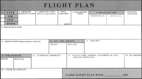
FLIGHT PLAN -
This route of flight follows well established departure, climb, cruise, descent, and landing procedures. You will depart Greater Kankakee Airport (Airport diagram in Appendix C3) on runway 34, and the departure time will be as we thought, 1300 Zulu. This will start off on a VFR flight plan, but the weather further south will be deteriorating enough to where it becomes necessary to file a pop up IFR flight plan.
The departure out of Kankakee will be a left crosswind departure to Roberts VOR, climbing to and maintaining 4500 feet. Your true airspeed is 120 knots. About 10 miles or so short of Roberts VOR, you will cancel your VFR flight plan and file an IFR one with Kankakee Radio.
Since Roberts VOR is the initial approach fix for the VOR/DME RWY 22R instrument approach into Willard-Champaign Airport (Appendix C3), you will be filing to VINEY intersection. The intent is to circle to land on runway 32L. Radar vectors might be given by Champaign Approach Control that are slightly different, so be ready for that eventuality.
You will be on the final approach course inbound on Champaign VOR's 028 radial, having descended to 2400 feet, where you will remain until crossing STADI intersection at 6 DME, which is the final approach fix. Champaign Tower should then pick you up. Then with DME capability, you will descend to 1400 feet by the 2.7 DME fix, which is called a stepdown fix. You can then descend further to a minimum descent altitude of 1160 feet which is a circling altitude minimum.
With the weather as expected, the field will come into sight before arriving at Champaign VOR. For landing on runway 32L, you will turn left to circle, in order to set up what looks like a right base, remaining at 1160 feet until your turn to final. Willard-Champaign's airport diagram is in Appendix C3. The weather being as it is, use Bloomington-Normal Airport as the alternate. You've shown how fuel on board is 6 hours and enroute time is about 50 minutes, so you're fat.
FILLING OUT THE FLIGHT PLAN -
Fill out the following Flight Plan completely, carefully paying attention to your route of flight, remembering that it's starting out as a VFR flight plan. Trace out your original route using the IFR low altitude enroute chart L-23 given to you in Appendix B3.
Now answer these questions from your flight plan and enroute chart.
** a) What is in block 8, Route of Flight, of your flight plan?
_________________________________________(10 pts)
** b) The length of Greater Kankakee Airport's longest runway is what?
_________________________________________(10 pts)
** c) If intercepting NEWTT intersection to the west of Kankakee VOR, what is the remaining distance to Willard-Champaign Airport along Victor 191 and Victor 429?
_________________________________________(10 pts)
** d) Around Roberts VOR, what is Chicago Center's sector name and frequency?
_________________________________________(10 pts)
** e) What are the geographical coordinates of Champaign VOR?
_________________________________________(10 pts)
"There's nothing like a good morning start to a day with a solid breakfast and another cross country flight in our buddy, 13MIKE! You've worked on all the preflight planning stuff already, and from what weather we know, it might get a little bit soupy heading south. But I purposely want you to experience the need to acquire an IFR clearance while enroute. So we'll depart here VFR and take it as far as we can.
Let me say a few things about the flight plan form itself. Do you see number five - Departure Point? And number nine - Destination? Because they're there, it won't be necessary to repeat them in the number eight block - Route of Flight. The Route of Flight block should have the components of your enroute portion of flight, but minus the departure and destination. This is so that blocks five, eight, and nine are then the whole cross country unit. Prima, hey!
Something else that comes to my mind concerns going direct to a point or navaid or place. Many times you '11 notice that pilots put a 'D' with a horizontal arrow through it, in order to show it's a direct route. There's nothing wrong with that, but it really is not necessary at all! Because if nothing is shown, then it must be direct. If you are taking a Victor airway to a point, navaid or place, then ‘V__’ would be written before its designation. Without that Victor series of letters and numbers, the only other option is that it's direct! Make sense? Small point, but I'm allowed to have pet peeves if I want them, and I've got them!
The last time I was in Kankakee, I went north. So I'm excited to be with you heading south in the direction of the Confederacy! Why don't you get what weather we need, and file to depart out of Kankakee VFR. It's a gorgeous day! Eight o 'clock will be as good a time as any to split out of here."
Table of Contents
Previous Section: Flight Scenario Two: Flight
Next Section: Flight Scenario Three: Weather Brief