IFR Flights of 13MIKE
by Fred J. Calfior and Douglas W. Miller
| Flight Scenario Seven |

Watsonville to Oakland |
(San Francisco Area - estimated flying time 70 minutes)
Watsonville! Watsonville! Where is Watsonville? Who was Watson anyway? Okay! Okay! I found Watsonville. It's south of San Jose on the coast. Pretty little place. Okay, now that I have found Watsonville, let's see where you will be going. Looks like you will be going to Oakland International Airport. You may have to do some fancy flying to get into this place, with the weather the way it is. They will probably make you fly some STAR and make you jump through hoops, and roll over or something like that! Well, let's look over the flight plan, and get a weather brief so Professor Calfior can get you airborne. He is trying to find Watsonville! I will try and give him directions, but you know Professor Calfior. You can lead him to water but he still can't find Watsonville! I'm sure he will arrive before departure time. He has never let a student down yet. Be kind to him when he does arrive. It's not easy trying to drive and read a low altitude enroute chart. It doesn't have any roads on it!
Read Professor Calfior's lips. He can help you nail these numbers and procedures. Even if he can't find Watsonville!
Don't bark when they have you roll over! It's not polite!
FLIGHT PLAN -
This route of flight follows well established departure, climb, cruise, descent, and landing procedures. You will depart Watsonville Municipal (Airport diagram and Departure procedures in Appendix C7) on runway 26, following the prescribed IFR departure procedures. Time to takeoff will be 1200 Zulu.
Upon getting airborne and safely established, you will commence a climbing left turn direct to PAJAR NDB, contact Monterey Departure Control, then proceed outbound on the 212 degree magnetic bearing to MOVER intersection on Victor 25. This is shown both on the Departure procedures and the IFR low altitude enroute chart L-2, of which the chart is in Appendix B4. You will climb up to and maintain 8000 feet cruise, where you'll reach a true airspeed of 125 knots. There is an 1800 foot restriction at MOVER intersection, but you will be well above that then, so you immediately can go outbound on the Salinas VOR 292 radial.
You'll be switched soon to Oakland Center. Upon arriving at SANTY intersection, try to get a radar vector to EUGEN intersection on Victor 27, which is on the Big Sur VOR 310 radial at 67 DME. It is now that you will begin the HADLY ONE ARRIVAL (Appendix C7) into Oakland International Airport.
From EUGEN intersection, track inbound on the Point Reyes VOR 144 radial inbound, through TAILS intersection and then to HADLY intersection. A descent into Oakland International Airport may commence at this point, after you turn right and go inbound on the Sausalito VOR 168 radial. You will be given to Bay Approach Control.
From the weather, runway 27 will be the active runway for ILS approaches, so you might find Bay Approach desiring you to arc around to the east, in order to set up for the ILS RWY 27R instrument approach. (Appendix C7) You will descend to some intermediate altitude, and either be vectored to the final approach course, or as stated previously, fly an arc.
Once established on the final approach course, minimum glideslope altitude will be 3500 feet, but can be dropped down to 3000 feet at ATC's discretion. This approach becomes interesting because you are tracking inbound on the localizer, but relying upon DME information from Oakland VOR. Decision height for this approach is 254 feet, and there's a good chance, because of the low cloud deck, that you might have to go missed approach. That means onward to San Jose International! But if the runway does pop into sight, then land straight ahead on runway 27R. Oakland's airport diagram is in Appendix C7. This should take you 70 minutes, which is a drop in the bathtub of your 5 hours and 45 minutes of fuel on board!
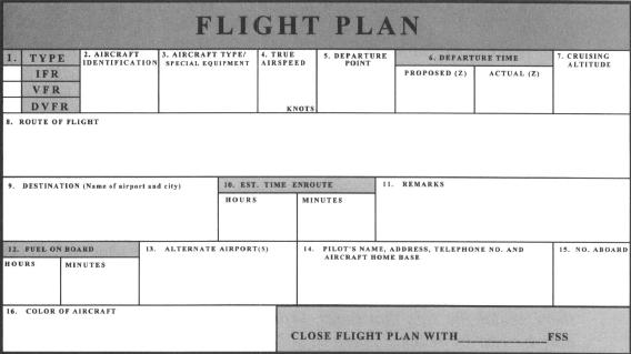
FILLING OUT THE FLIGHT PLAN -
Fill out the following Flight Plan completely, carefully paying attention to your route of flight. Trace out your route using the IFR low altitude enroute chart L-2 (Appendix B4).
Now answer these questions from your flight plan and enroute chart.
** a) What is in block 8, Route of Flight, of your flight plan?
____________________________________________________(10 pts)
** b) What is the minimum obstruction clearance altitude for the leg on Victor 25 between MOVER and SANTY intersections?______________________(10 pts)
** c) Off of what VOR does EUGEN intersection's minimum reception altitude pertain to?______________________________________(10 pts)
** d) How many miles is it from EUGEN to HADLY intersection, and then direct to Oakland VOR?_____________________________________(10 pts)
** e) How many different Victor airway radials extend outward from Oakland VOR?_____________________________________(10 pts)
"By casting my eyeballs in the direction of the skies, I can safely say there's a fairly low cloud deck. No thunderstorms, as far as I can see or hear. Just a pretty day to go flying all in all.
Did I ever tell you that I flew into a thunderstorm once? Daggondest thing! All the dumb things I've done were while I was in the military, but the thing was embedded and poof! I was in it! It's a whole new world inside a thunderstorm cell! An adjective befitting the interior is violent. Updrafts, down drafts, side rides, you name it - they're there! According to the AIM, the best thing to do is to hold your attitude and make a one hundred and eighty degree turn to fly back out where you flew in.
I stress the word ‘attitude’, because your airplane is dancing to heavy metal rock and roll music inside. To try to hold an altitude will over stress your airplane. And to maintain an airspeed is impossible because you are literally at the mercy of the storm cell. By holding an attitude, your airplane is being bounced around, but you're not fighting it, so you are not inducing any stress yourself on the airplane.
So I simply worked on a standard rate turn for sixty seconds, rolled out, and almost immediately, I was out! Now that I think about it, this would be a good visual simulator drill for every pilot to experience. It sure opens your eyes to the power of a thunderstorm, and why you don't play with them, or even try to get close.
Go ahead and get our weather if you would. The phone is right over there, under the sign that reads, ‘Tony the Terminator ate lead here, may he rest in peace!’ There're still pockmarks on the wall, too! I'll tell you what, use the other phone over there! I can't afford to lose a customer!"
Table of Contents
Previous Section: Flight Scenario Six: Flight
Next Section: Flight Scenario Seven: Weather Brief