IFR Flights of 13MIKE
by Fred J. Calfior and Douglas W. Miller
| APPENDIX B |

San Francisco Low Altitude Enroute Chart L-2 |
These charts are obsolete and are not for real-world navigation.
The Low Altitude Enroute Chart, for the San Francisco and Watsonville flight scenarios, is on the following two pages. The map scale is 1" = 10 NM. Study the chart, there is a wealth of information on it. The area that this section of the chart covers is illustrated in Figure B.4.
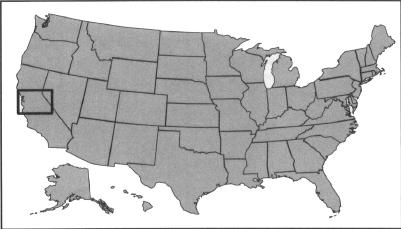
Figure B.4
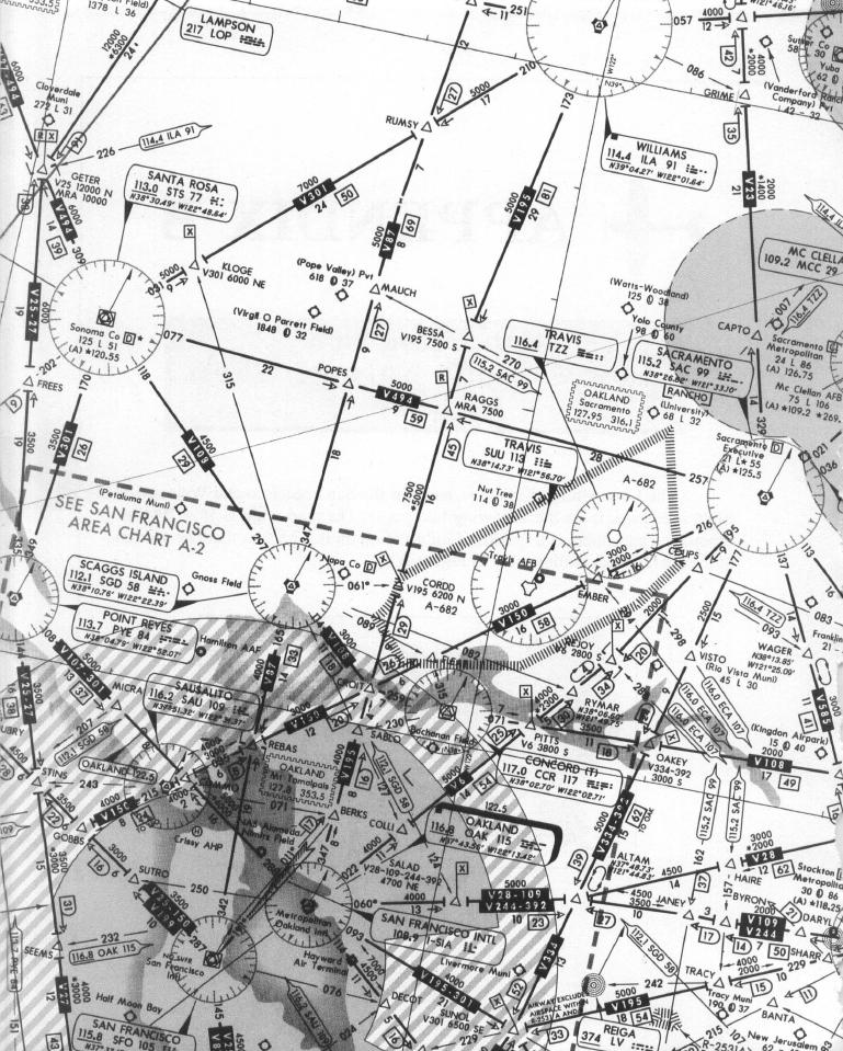
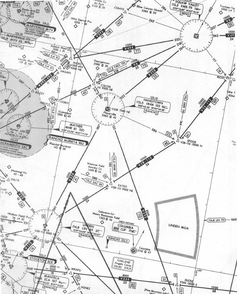
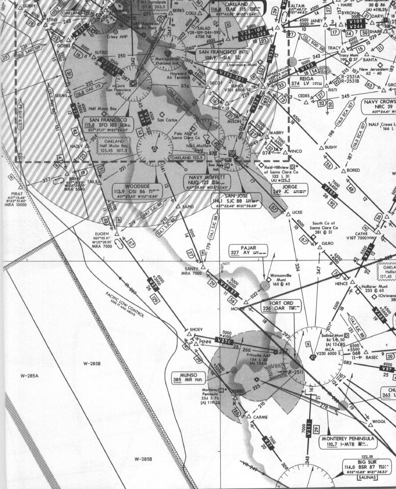
Table of Contents
Previous Section: Chicago Low Altitude Enroute Chart L-23
Next Section: Seattle Low Altitude Enroute Chart L-1