40 Great Flight Simulator Adventures
by Charles Gulick
Long Island
It Is
It Is
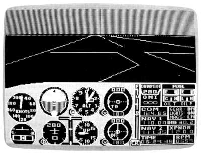
| North Position: 17352 | Rudder: 32767 |
| East Position: 21751 | Ailerons: 32767 |
| Altitude: 105 | Flaps: 0 |
| Pitch: 0 | Elevators: 32767 |
| Bank: 0 | Time: 6:28 |
| Heading: 280 | Season: 4-Fall |
| Airspeed: 0 | Wind: 3 Kts, 320 |
| Throttle: 0 |
 |
It's dawn, and you're right at
the base of the 2 of the numbers for runway 28, at Rhode Island's Block
Island State Airport. Daylight turns on in a minute or so-at 6:30. Watch it happen through your windshield. The black landscape suddenly turns green as it's bathed in early sunlight. Beautiful morning to go flying. And, if you're a bird lover, keep your eyes open. Nearly every northeastern species can be seen here this time of year, since birds use the island as a primary migration checkpoint. It also has fine beaches and is a mecca for bicyclists, fishers, and beachcombers. |
 |
We're flying contact this
morning, so whenever you're ready take her
off. (Watch for the opposite runway numbers to sail by under you.) Your aircraft is pointed toward the mouth of Long Island Sound. Stay on your heading of 280 and get straight and level at 2000 feet. |
|
Long Island, New York, is left
on your windshield, and the southern
edge of Connecticut can be seen on the right. Directly behind you is
Block Island. In the far background is Martha's Vineyard, then lots of
Atlantic Ocean. |
 |
As you fly, add about five to
ten degrees to your heading so that the
farthest expanse of water lies straight ahead of you, and the landfalls
are about equally divided to left and right. Zoom out to a high altitude radar view to confirm that you're headed straight up the arrowhead of Long Island Sound. Then just keep on keepin' on. You can pretend it's on automatic pilot if you like and go make yourself a cup of coffee. Or sit back and clip your fingernails. Long Island Sound is a long hunk of water. And Long Island is a heavy piece of geography, as people who ride the Long Island Railroad or drive the Long Island Expressway to Manhattan every day will testify. And really, that's part of what flying is about, isn't it? The drone of the engine. The only slightly, slowly changing landscape ahead. A point far away on the horizon. A place where sky and water divide exactly in half. It's the kind of thing that gradually bleeds the stresses out of you, like sitting at the end of a fishing pole for a couple of hours or looking at stars. You can break the monotony by occasionally trying to raise the control tower at Igor 1. Sikorski Memorial, 120.9. Maybe this early in the morning Igor Ivanovich (who among other things built the first helicopter in 1939) himself will be operating the microphone. Except he went to the great heliport in the sky in 1972. When you get close enough, anyway, the tower will respond. |
|
Meanwhile, tune your NAV to
Bridgeport VOR, 108.8, and at least you'll know how many miles it is to
his airport. Not that we're going there. But we'll see it. This is a good trip for practicing things like holding religiously to an altitude, changing altitude, tuning OMNI stations to establish your exact location (your New York/Boston chart is literally buzzing with them), and exploring radar views. Or you might want to practice wagging your wings, power on and power off stalls, climbs and glides, even loops. Whatever it is, you've time on your hands. Just keep getting back to your heading. Visually. Up the Sound. And your altitude, 2000. Eventually you'll make out a highway zipping in from the right side of your windshield. It's Interstate 91, which joins up with and becomes Interstate 95 where it parallels the shoreline up ahead. It's the same I-95 that eventually bends west and crosses the Hudson River at the George Washington Bridge. |
|
About here you should be able to
raise Sikorski, or they'll raise you.
To call a station you're tuned to when you think you're in its range,
just hit C on the PC, Shift-C on PCjr, and Control-C three times on all
other machines. Keep flying straight toward what seems to be a point where Long Island and Connecticut almost touch. The Sound points to it like an arrowhead. But it's an optical illusion-or a simulator illusion. As soon as the simulator accesses the disk, you'll see the point disappear. And a radar view will show you're headed more for the shore of Connecticut than you are following the contours of Long Island Sound. So make a shallow left turn to a heading of about 260, and again you're over open water. Correct again so that you have equal shoreline to left and right and are pointed toward the farthest expanse of open water you can see. |
|
Take a look out your right side
now, and perhaps you'll spot Tweed-New Haven Airport, with its runway
right at the water's edge. Then you'll see Sikorski, also with an overwater approach. Your DME will tell you how far out over Long Island Sound you are. As you pass Sikorsky, take the highest altitude radar view you can (the one before the greenout) and be sure your nose is pointed right up the new arrowhead toward its tip. Make any small corrections necessary to point it there. The horizon will take on different aspects as you fly the ever-narrowing Sound now. Little juts of land will appear and disappear. And a highway will take shape on the left side of your windshield. That's Interstate 295, which connects Long Island and the Bronx via the Throgs Neck Bridge. Shortly, you'll see the two highways, like snakes, strike at each other across the water. They become one, forming a bridge. |
|
Check radar now and zoom in a
notch closer. You'll see that the bridge
is actually two bridges-the nearer one Throgs Neck and the farther one
Bronx-Whitestone. The highway across the latter is Interstate 678.
Continue to point toward the tip of the arrowhead (right now, beyond
the bridges, it becomes a slot). |
|
A little farther on, try to spot
Westchester County Airport out your right side window. Things will start shaping up now. Keep a lookout for an airport ahead, just a hair to the left of your course. It's La Guardia, named for a wonderfully pixieish mayor (1934-1945) of New York City, Fiorello H. La Guardia, who used to read the Sunday comics to kids over the radio. The airport is just beyond the Throgs Neck and Bronx-Whitestone bridges (those long highwaylike bridges you'll shortly fly over-toll bridges to the ordinary mortals below). Stay on your heading and let La Guardia slip by slightly to your left. As it does, there's a disk access and you're aimed at the heart of Manhattan. |
|
Take a look on radar and adjust
zoom until you see that
the water you're flying over takes a 45degree turn to the left not far
ahead. At that point, it becomes the East River. |
|
Turn with and track the river.
If you've flown certain earlier modes in
this book with us, you know that the buildings on your right are, in
order, the Empire State Building and the twin towers of the World Trade
Center. The first bridge you see is the Queensboro Bridge. Directly
under that bridge, but not visible in the simulation, is the southern
end of Roosevelt Island, a small strip of land that has become a New
York City community on its own. And just beyond Roosevelt Island,
though not visible even if you were standing on the riverbank, the
Queens-Midtown Tunnel lopes under the river. Two more bridges lie ahead. The nearest one is the Williamsburg Bridge, and just beyond that, the river bends to the right and passes under the Manhattan Bridge. You might want to lose a bit of altitude to get a closer look. When you pass Manhattan Bridge-a 3-D feature of the simulation-you're over Upper Bay, at the mouth of the Hudson River, with the tip of Manhattan to your immediate right and the Statue of Liberty probably visible as a dot in the bay. Worthy of mention is that you've also flown over, a moment after passing Manhattan Bridge, the famous Brooklyn Bridge, unseen in the simulation, but enshrined forever in the poetic inspiration of Thomas Wolfe who walked it often. (If you are interested, I can make you a deal on the bridge.) |
|
As you approach the middle of
the bay, make a left turn to a heading of
175 degrees. If you lost altitude earlier, get back to 2000 now. The land to your left is Brooklyn, and to your right Staten Island. Beyond these are Lower Bay and the Atlantic Ocean. When you're over Lower Bay, turn left again and head due east. You'll be flying along the southern shoreline of Long Island. The airport ahead to your left is John F. Kennedy International. As you fly past it, tune your NAV to Deer Park OMNI, 111.2, and set your OBI to fly directly to the station. Your destination is Republic Airport, about six miles this side of the OMNI. Since there's no tower in the simulation for Republic, call JFK on 119.1 and check the winds. If there are still none or if they're light, land on the runway of your choice. Runways are 1-19 and 14-32. Alternative: If you just haven't had enough flying for one morning, continue right up Long Island's southern coastline. It'll point you back to Block Island, and you'll be there in plenty of time for lunch. |
Table of Contents | Previous Section | Next Section