40 Great Flight Simulator Adventures
by Charles Gulick
Making
Tracks
Tracks
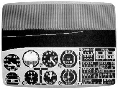
| North Position: 17642 | Rudder: 32767 |
| East Position: 21351 | Ailerons: 32767 |
| Altitude: 174 | Flaps: 0 |
| Pitch: 0 | Elevators: 32767 |
| Bank: 0 | Time: 5:25 |
| Heading: 180 | Season: 3-Summer |
| Airspeed: 0 | Wind: 7 Kts, 165 |
| Throttle: 0 |
| Daylight is still a few minutes
away as you prepare to depart runway 19 at Bradley International,
Windsor Locks, Connecticut. You're out early because you're going on a long trip-not in terms of flying time, but of time itself. In a sense, you're going to fly back through it. Also, it's a Saturday, and you don't want to waste any of your precious weekend. |
|
 |
Tune your NAV to Madison VOR,
110.4, and set the course selector to 196 before your departure. |
 |
Take off when you're set, and
climb out on the 190-degree runway
heading. As you pass through 1000, turn slightly right to exactly 196.
Level off at 2500. |
 |
When you have the altitude and
daylight, switch on radar and zoom out
until you see a little wedge of Long Island Sound ahead. The highway,
the only one you see, is Interstate 91. Back to your out-the-windshield view, the airport ahead, just east of I-91, is Hartford-Brainard. And now you can see Long Island Sound, even though it's some 30 miles away. Take a look behind at the airport you just left. As Hartford-Brainard disappears off your windshield, you might want to go into radar and zoom in until the runways appear, looking like a railroad signal or half a pole-vaulting rig. Then return to your out-the-windshield view. |
|
|
Now, be sure to include the DME
regularly in your instrument scan. When
it reads 21 miles, take a ground view, looking directly down past your
wheel, and poise your finger over the Pause key. When the reading is
20.4, press the key. Why are we looking down at this particular patch of green? There is absolutely nothing to distinguish it from thousands of miles of green elsewhere in the simulator (and the world). At least, nothing we can see. But look harder. You're just south of a town named Rocky Hill. And there used to be a river where you're gazing. About a mile to the left of this point is what's left of the river, now called the Connecticut River (it doesn't appear in the simulation). The river began to dry up awhile ago-two hundred million years ago to be inexact. And the area you're looking down at became very muddy. So muddy that the dinosaurs who strode the earth at that time left their tracks in the mud. And the tracks became embedded in the earth's crust, more or less permanently (fossilized). There are hundreds of such dinosaur footprints down there below you, a bit south of Rocky Hill, Connecticut. And that's why they've named the area Dinosaur State Park. If you can't see the footprints from where you are, perhaps you're just not looking hard enough. |
|
Time now for breakfast. Why not
make a slight turn right to a heading
of 210? It'll take you straight to Tweed-New Haven Airport in a matter
of minutes. They'll be landing on runway 20, elevation 13 feet. Or if
you're starving, that's Meriden Markham Municipal you see a little
ahead across the highway. Then when you've had your bacon and a couple of dinosaur eggs over light, you can make tracks again. |
Table of Contents | Previous Section | Next Section