40 Great Flight Simulator Adventures
by Charles Gulick
Of Sound
Mind
Mind
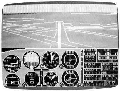
| North Position: 21526 | Rudder: 32767 |
| East Position: 6666 | Ailerons: 32767 |
| Altitude: 603 | Flaps: 0 |
| Pitch: 0 | Elevators: 32767 |
| Bank: 0 | Time: 10:30 |
| Heading: 180 | Season: 3-Summer |
| Airspeed: 0 | Wind: 4 Kts, 140 |
| Throttle: 0 |
| Runway 20 at Snohomish County
Airport (Paine Field), Everett,
Washington, is the smallest of the three strips. But plenty long enough
to launch us on a nice sightseeing tour of one of the simulator's most
scenic water areas-Puget Sound. |
|
 |
Before you taxi into position,
tune your NAV to Paine VOR, 114.2, and
set the OBI to the runway heading, 200, so we'll have a common distance
reference. Your DME will read 0.6 nautical miles. (You'll readily see
that there's a ten-degree error in the numbers for this runway on your
simulator chart.) |
 |
Zoom out on radar until you see
the Sound on your right and a highway
far to the left. The highway is Interstate 5. We'll take off and fly
straight on to the center of the Sound. Now zoom in until you have good reference for the runway, just ahead of you. |
 |
Taxi out, get lined up heading
200, and take off as soon as you're ready. Climb straight out and level
off at 2000. When your DME reads 3.7, turn left to a heading of 170. You're now looking and flying down Puget Sound, toward Seattle center. |
|
At about 5.5 miles, go into
radar and zoom out until you see a second
highway south, forking off from Interstate 5 to skirt the eastern side
of Lake Washington (about eleven o'clock from your position). That
highway is Interstate 405 to Bellevue and Renton. The land jutting out
on the western side of the Sound is Point Jefferson, which is just
slightly east of Port Madison Indian Reservation and a few miles from
the grave of Chief Seattle of the Suquamish tribe. If you take a right-front view at about 6.8 miles, you'll be looking directly into the body of water called Port Madison and toward the site of the Chief's grave on its banks. A left front view will show you the northern area of Lake Washington and the network of highways serving Seattle. |
|
At about 15 miles take another
look out the left front and you'll see
the Space Needle, which we encountered in an earlier chapter. That's at
Seattle center. As it passes, look directly out the left side and
you'll see two bridges crossing Lake Washington. The University of
Washington is just north of the first one, and Seattle University just
north of the second. The second bridge touches down on Mercer Island
and continues as Interstate 90 all the way west to Spokane and beyond.
The mountains in the background are part of the Cascade range, which
stretches from top to bottom of the state, and includes Mount Rainier,
which is about on the horizon. The Cascade range confines most of the rain in the northwestern part of the state to the Puget Sound area, which is why this area is so green-and has so many waterways, bays, and islands. |
|
When your DME reads about 21
miles, turn left ten degrees and head 160. |
|
A few miles later, go into radar
and adjust zoom until you see a point
ahead of you where the Sound narrows and bends to the right. You'll be
able to see this point out your windshield, now or shortly. |
|
Aim your aircraft toward it. What looks like an airport developing ahead of you is exactly that. And if you've flown other modes in this book, you've been there before: Tacoma Narrows. Remember the runway that reaches right out into the water? However, Tacoma Narrows isn't our destination this time. Plan to fly around the point and out over the bay. When radar shows you're beyond the point, turn right to head approximately 222, or whatever course takes you toward the next narrow passage of water, with another bay beyond that. Radar will help you line up if you have trouble spotting it. Now tune Olympia VORTAC on 113.4 and get a heading direct to Olympia Airport. You'll find you're approximately 16 to 19 miles out. Call the tower on 124.4 and find out which way they're landing. Chances are it's on runway 17. And you probably have the airport in sight. Elevation at Olympia is 206 feet. A bit of judicious aileron work should get you lined up for a straight-in approach without much trouble. And you'll have seen all of Puget Sound in about 45 minutes. Happy landings. |
Table of Contents | Previous Section | Next Section