40 Great Flight Simulator Adventures
by Charles Gulick
Night Has a
Thousand Eyes
Thousand Eyes
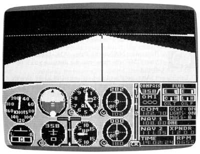
| North Position: 21371 | Rudder: 32767 |
| East Position: 6481 | Ailerons: 32767 |
| Altitude: 370 | Flaps: 0 |
| Pitch: 0 | Elevators: 32767 |
| Bank: 0 | Time: 19:00 |
| Heading: 40 | Season: 1-Winter |
| Airspeed: 0 | Wind: 4 Kts, 330 |
| Throttle: 0 |
| The area is Seattle, and the
airport is Port Orchard Airport,
Washington, on the west side of Puget Sound. You're in position to taxi
onto runway 36 for a night flight to Snohomish County Airport (Paine
Field). |
|
 |
Tune your NAV to the Paine VOR,
114.2, and your DME will show you the distance you'll be flying. Also, go ahead and set your OBI to fly directly to the station. What heading will you take up when you've departed Port Orchard? |
 |
Before you leave, get into radar
and zoom out. The large body of water
on three sides (though it looks like land) is the Sound, and the
highways on the other side are Interstates 5 and 405. Interstate 5 goes
to Seattle and continues north. Interstate 405 goes to Bellevue, which
is across Lake Washington from Seattle, and then joins up with I-5. Your flight will take you across Puget Sound and over the northern outskirts of Seattle. The airport is a few miles ahead and to the left of where the highways join. |
 |
Take off when you're ready.
Since your cruising altitude will be above 3000 feet, observe the
regulations: Heading 0-179 degrees: altitude = odd thousands + 500 Heading 180-359 degrees: altitude = even thousands + 500 So, cruise at 3500. After the disk access, you can see how I-5 and 1-405 merge ahead of you. They point the way (though it's rather difficult to separate them visually from the coastline in the simulation). Hold your altitude and keep the needle centered. |
|
When your DME reads about 20,
tune Snohomish ATIS, 128.65, and see what's what. If the winds haven't shifted, they're probably landing on runway 29, so begin thinking about your approach. Assume a lefthand traffic pattern. If you're not familiar with it, the traffic pattern around a small airport can be visualized as a series of 90-degree turns, creating a box. The active runway represents, of course, the heading for both takeoff and final approach, also called the upwind leg. After takeoff, the first 90-degree turn, whether left or right, puts you on the crosswind leg. The next 90-degree turn puts you on the downwind leg, and the next on the base leg. The last turn puts you on final (final approach). In the simulator, since we have no actual conversations with the tower (except for standard advisories and active runway information where available), I regard all airports as "small" airports and fly the small-airport traffic pattern. With similar bravado, I decide whether they are flying a right- or lefthand pattern to suit myself. Then (sometimes, but certainly not always) I enter the pattern at a 45-degree angle with the imagined traffic. Or, depending on my heading, I simply squeeze myself onto whatever leg is convenient. There's a product available at most small airports called PDQ (there are other equivalent products, I'm sure). It's a Visual Airport Guide consisting of three plastic pieces riveted together like a circular slide rule. PDQ allows you to visualize your aircraft heading, the runway heading, 45-degree entry angles, and the traffic pattern you're going to enter. What it does, essentially, is eliminate the math involved in deciding what headings put you on what legs, thus, simplifying your entry into a pattern. It answers very quickly questions like "what's base for runway 29?" Just happen to have that information right here. Base for a runway heading of 290 and a lefthand pattern is 20 degrees. So, since you're now heading somewhere in the vicinity of 6 degrees, think about a shallow right turn to base when the time comes. |
|
When Snohomish is 17 to 18 miles
ahead, it'll become visible on your windshield. Time to start planning
your letdown. |
|
A high altitude radar view, even
this far out, will show you the
airport (the big airports get all the breaks in the simulator;
sometimes it seems like the little ones never show up). The elevation at Snohomish is 603 feet. Pattern altitude (normally 800 to 1000 feet AGL) would thus be about 1400 indicated, minimum. Sounds okay for base leg. The FAA sectional shows Snohomish is about five miles north of the Interstate 5/405 junction, so plan your turn to base accordingly, using radar and/or right side views of the junction. |
|
You'd be well advised to get
into classic approach configuration for
this landing for several reasons. It's night. Runway 29 is the least
conspicuous of the runways. You're tired. So, don't have too much speed; do have some flaps on base leg; watch for the depiction of the runway on radar; and, remember, it's going to be at 90 degrees to your heading. |
|
Take out-the-windshield views so
that you always know where the airport
is; take ever-closer-in radar views until you know which runway you're
bound for; don't get dazzled by the lights; note that Martha Lake strip
is across the highway from the threshold of 29; don't forget the carb
heat; try to have at least 1000 feet indicated when you turn final; and
don't wait too long to do that; and let's see, what else? Oh, yes-don't
forget your umbrella. It might be raining in Snohomish. And once you're on the ground, have a look at all those lights-out the windshield and on radar. |
Table of Contents | Previous Section | Next Section