40 More Great Flight Simulator Adventures
by Charles Gulick
Reconnaissance
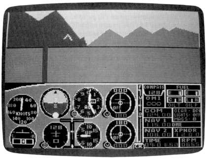
| North Position: 17386 | Rudder: 32767 |
| East Position: 7407 | Ailerons: 32767 |
| Altitude: 410 | Flaps: 0 |
| Pitch: 0 | Elevators: 32767 |
| Bank: 0 | Time: 9:00 |
| Heading: 128 | Season: 2-Spring |
| Airspeed: 0 | Wind: 4 Kts, 55 |
| Throttle: 0 |
| You're on the grass alongside
runway 6L, at what used to be (since this
is no longer 1917) Enemy Base 2 in the simulator's WWI battle zone. Get
out your illustration of the zone in the simulator manual. Enemy Base 2
is at the southern, or near, end, just east of a factory and north of a
fuel depot. During the war, these were two of the numerous U.S.
targets. (And isn't it amazing, that with the hundreds of thousands of
pilots who dropped bombs on this zone, even just this year, not one
target was demolished? Every one of them is still standing intact.) Under peaceful blue skies, we're going to fly a little reconnaissance of the zone this morning in our modern aircraft. The area covers about a hundred square miles, with mountains, the river, the one-mile grid marks, and the various buildings and airstrips creating scenic interest. |
|
 |
Ready your aircraft for takeoff,
then taxi into position on the runway and hold. Access radar and zoom to the view which shows you the two parallel runways, the taxiway joining them, and some of the parking area off the taxiway. Zoom one notch higher, and you'll see that the taxiway and parking area disappear and that the two runways are represented simply by two parallel lines. Two more notches higher (three notches in the Piper) and the southern end of the river appears, along with the western mountain ridge. Notice the fuel depot just south of your position and the factory complex at the base of the mountain. However, there's a factory missing, if our maps are to be believed. There should be a factory right off your tail, but radar doesn't reveal it. Either one factory was wiped out in 1917, or the camouflage is very clever. Maybe from the air we'll check this. |
 |
Now return to your
out-the-windshield view and take off, climbing
straight out to 1000 feet. As you pass through 1000 feet, bank 30
degrees and turn right, to a heading of 180, or due south. Level off at
1500 feet at pattern airspeed. Once level, set up a direct rear view, and keep flying on your 180 heading until the entire zone is visible behind you. Use the time to get the exact altitude, 1500, and pattern airspeed, slow flight. Take left and right rear views to get a feel for how much farther you'll be flying before the entire battle zone is in view. Once there's some green on both sides of the battle zone scene (direct rear view), return to your forward view and turn left to fly a heading of 90 degrees. When on that heading, take a 90-degree view off your left wing tip. Once you're opposite the point where the mountain range and the easternmost grid line come together, turn left again and head due north. The edge of the grid and the foot of the easternmost ridge of the mountain should be just about straight in front of you. They should be in a line such that you're flying along the eastern edge of the battle zone. That's our objective, so make whatever adjustments you must to get into that position. You don't have to be exactly aligned, but you should be flying pretty much along the "edge," with the eastern boundary straight ahead, and on a due north heading as you approach the zone. When you're about three miles from the edge of the battle zone, you'll be able to check your position on radar, and once inside you can zoom one notch closer to pick up some details. |
 |
The first things you'll observe,
on radar and using your left side
views, are Friendly Base 2 and its fuel depots, this side of the river.
Another mile or so north is the main airbase, Friendly Base 1. As you
pass this, take a 90-degree view to the left. As the last mile marker before the mountain range slips under your nose (forward view), turn left and head 270, due west. Then, when you're over the river, turn left and track down the middle of it. A view out the left side will show you Friendly Base 1 again, about two miles away. Quite soon, ahead and to your left, you'll spot Friendly Base 2. About the same time, famed Enemy Base 1 should be visible out the right side. As you near the end of the river, you'll see the airport we took off from, but still no sign of the enemy factory that's supposed to be about a mile west of there. Fly beyond the grid lines, then circle to your right around the airport and get on a north heading just this side of the mountains. A nice shallow bank should do it. When you're opposite the airbase you just circled around, take a right side view and you'll see the Ghost Factory, very massive and real, exactly one mile this side of the runways. Out front, another factory will suddenly spring into view. If you miss it out front, take a straight-down or, ultimately, rear view. No wonder these factories were so hard to hit. They must be camouflaged with mirrors. |
|
Put on some flaps, and set
yourself up to land on runway 4 at Enemy
Base 1, just a couple of miles ahead. Squeeze over as close to the
mountains as you can, because you'll need some room to make your turn
for runway 4. Once you're on the ground, take a look around. Pretty fancy base the Boche had, hmmm? But now, the whole battle zone is yours to fly around in. Use this mode as your tie-down, or the mode in Adventure 10, "Time Warps," as your starting point, and fly the whole area whenever you like. The reconnaissance will be useful, should you ever go into the World War I Ace mode on a Sunday afternoon. You just slip down the river and sneak up on the factory by ... well, you know how. |
Table of Contents | Previous Section | Next Section