40 More Great Flight Simulator Adventures
by Charles Gulick
Down with
Rectitude
Spanaway III
Rectitude
Spanaway III
| North Position: 21183 | Rudder: 32767 |
| East Position: 6733 | Ailerons: 32767 |
| Altitude: 4000 | Flaps: 0 |
| Pitch: 0 | Elevators: 32767 (IBM) |
| Bank: 0 | Elevators: 34185 (Apple) |
| Heading: 339 | Elevators: 36863 (64 and Atari) |
| Airspeed: 120 (IBM only) | Time: 15:30 |
| Airspeed: 126 (all except IBM) | Season: 3-Summer |
| Throttle: 22527 | Wind: 0 Kts, 0 |
| Note:
Use Pause frequently during this adventure, and regularly read ahead so
that you know when to do what. |
|
 |
Time now to tune McChord OMNI on
109.6 and get a heading to the
vicinity of Spanaway Airport. Center the OBI needle, then turn smartly
to the heading indicated. Your course will probably be somewhere in the
vicinity of 225 to 245, but as long as the needle's centered, that's
the radial you want to fly. You should be straight and level at 4000 feet, so if you're not, it's time to get that way. |
 |
Very soon, you'll be able to see
some of the southern portion of Puget
Sound ahead. The highways swinging in from the north are Interstates 5
and 405. Just south of where they merge to become 1-5 is the city of
Tacoma. And at the southern tip of Tacoma is our destination airport,
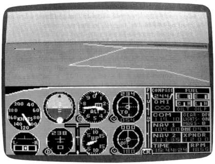
Spanaway. Elevation 385 feet. Note your rpm reading. This is the power setting it takes to cruise straight and level-with elevator at operational neutral-at the altitude you're flying. (Your aircraft may not hold its altitude exactly; you'll have to add 100 rpm occasionally-use 50 rpm in the Cessna-then reduce by that much again.) Now we'll try an experiment. |
 |
Make just this single control
change-reduce your power to 1905 if
you're flying the Cessna, or in the case of the Piper, reduce power two
notches. Don't make any elevator/trim adjustments. You'll soon find
yourself descending at 250 to 300 feet per minute. In your instrument
scan, pay special attention to your altimeter and your vertical speed
indicator. Note that as your altitude decreases, so does your rate of
descent. While you go from 4000 to 3000 feet, your rate of descent
drops from 300 to considerably less than that. And as the descent
continues, the VSI indicates an ever shallower rate. Will this go on
indefinitely until the VSI reaches zero? Yes. Then, still with the same settings, will the aircraft start to climb? No. Remember the operationally neutral elevator setting (and forget the fact that you're overflying McChord, and Spanaway, too, in this demonstration. What we're learning here is important, and we'll go back and fly home shortly). Continue straight ahead until your VSI, other instruments, and out-the-side views indicate you're straight and level. It takes a while because your rate of descent gets ever slighter as your altitude bleeds off. Somewhere in the general vicinity of 2300 to 2500 feet you'll stop descending. And you won't start climbing. Here's more proof that pitch follows power. (And it's worthwhile noting that your airspeed has varied little more than a hair all the while.) If pitch follows power, it follows that we can increase our pitch (up or down, but in this case down) to whatever we want simply by increasing or decreasing power setting. And by the same token, we can precisely control our rate of descent or climb to match any objective-such as getting to pattern altitude in a given number of minutes-by varying power only. Because our procedure keeps airspeed constant. As soon as you're satisfied that the airplane flies straight and level when you combine a specific rpm with operationally neutral elevator/trim, you'll be ready to go to the next paragraph. There we'll learn how to "let down" from a given altitude in a given number of minutes to put ourselves at or near pattern altitude for our destination. |
|
Restart this flight. Your NAV is
already tuned to McChord OMNI, and
you're probably around 30 to 40 miles from the station. Center the OBI
needle and turn to the exact heading for McChord as soon as you can. Consider this: You're at approximately 4000 feet. Spanaway's elevation is 385 feet. Pattern altitude there (or at any airport, unless advised otherwise) is 800 to 1000 feet above ground level. In the case of Spanaway, that means pattern altitude is somewhere between 1185 and 1385 feet. For our present purposes, let's say 1400. That's your target altitude-the altitude you want when you enter the traffic pattern at Spanaway. So a bit of brilliant mathematics (4000 minus 1400) tells you you'll want to lose 2600 feet somewhere between here and Spanaway. Fine. But you don't want to lose it just any way and just any time. We're being precise around here. Part of being precise is that we'll always (or normally, at the very least) use a descent rate of 500 feet per minute when descending from cruise altitude to pattern altitude enroute to a landing. This means we need two minutes to lose a thousand feet. That gives us the formula T = A X 2 where T is time in minutes and A is altitude change required in thousands of feet. Thus, it will take about 5.2 minutes to lose 2600 feet of altitude (2.6 X 2 = 5.2). Note that the same formula works for altitude gain as well, so long as our VSI reads 500. For making quick mental calculations, we can figure our aircraft travels about two nautical miles per minute. Multiplying the minutes we need for the desired altitude change by two gives us the distance we need for making the change. The formula is thus D = T X 2 where D is distance required and T is time in minutes. It will require about 10.4 miles to lose the 2600 feet of altitude. Unfortunately, we never fly an absolute straight line, either horizontally or vertically, and it takes time to transition from straight and level to 500 fpm down (or up). Add to that the fact that we want time to get into pattern airspeed before we get into the pattern. So it's best to be on the conservative side when using these formulas. We also have to consider the wind strength and direction, probable variations in airspeed, instrument error, and such. Clocking your flight for a minute while checking the distance traveled on your DME will give you as accurate an estimate of your groundspeed as you're going to get, and that's a reasonable figure to use. But don't be dismayed if you're a minute or so off in your timing and a few hundred feet or more off your altitude. The formulas are simply aids to calculations that you'll make while you fly. What you see out your windshield and what you have to do as you come up on your destination are all factors in the last phase-and every phase-of your flight. By the way, another formula for start-descent distance, one without reference to time, is SD = A X 4 where SD is start-descent distance, and A is the altitude (in thousands of feet) that you need to lose. This formula assumes that at 120 knots, you'll travel four nautical miles in the two minutes it takes to descend 1000 feet. If the DME signal, which radiates from the VOR station, is not precisely at our destination, simply interpolate a bit, using your chart and precision measuring equipment like a thumb or a pencil eraser. (Here again, the lack of detailed charts in the Microsoft version becomes apparent-if you're flying the Cessna, I highly recommend that you get yourself some FAA sectional charts.) |
|
With all this information, go ahead and plan your letdown for Spanaway. But as soon as your VSI indicates a steady 500 fpm descent, exit to the editor. If this is your first flight in the present adventure, type the number 114 to set up the existing in-flight parameters as User mode 14 (or use any available mode you wish if you're not storing these adventures in sequence). Save the mode. Then you'll be able to return to this moment of this flight and refly it. |
Table of Contents | Previous Section | Next Section