40 More Great Flight Simulator Adventures
by Charles Gulick
Red Quiver
Valley
Valley
| North Position: 17416 | Rudder: 32767 |
| East Position: 7404 | Ailerons: 32767 |
| Altitude: 410 | Flaps: 0 |
| Pitch: 0 | Elevators: 32767 |
| Bank: 0 | Time: 9:00 |
| Heading: 180 | Season: 2-Spring |
| Airspeed: 0 | Wind: 4 Kts, 270 |
| Throttle: 0 |
| Soldiers in all wars have had a
habit of applying code names to places
where they lived and fought. And fought to live. What we've been
calling Europe 1917 is no exception. I'll give you the names of all
such places for the Europe 1917 sector so that you can fly by them
hereafter. For no immediately obvious reason, all these names are
American Indian-style names. Of course, you can forgo these and use your own. But I assure you that, if you do, no one will have the foggiest idea where you're talking about. Along with the names, I'll give you other pertinent data that will help you fly hereabouts. |
|
 |
Get out your manual and turn to
the map of the WWI Ace battleground.
The entire ten-square-mile area is called Red Quiver Valley. This for
the simple reason that the river which virtually divides it has the
fanciful name Red Quiver River (possibly because many a pilot was
quivering as he flew across it into enemy territory). Clockwise, beginning with the WWI Main Base in the upper right-hand (northeastern) corner, here are the names of the airports and the numbers for their runways: Eagle Field (originally Main Base, or Friendly Base, 1) Named for its shaky resemblance to an eagle as seen from the air. Runways: 9/27, 15/33 Elevation: 410 Axe Handle (originally Airbase, or Friendly Base, 2) Named for appearance similar to hatchet or axe as seen from the air. The handle is the runway. Runway: 11/29 (nominal) Elevation: 400 Quiver City (originally Enemy Base 2) Named for its proximity to Red Quiver River and its supposed similarity to a quiver when seen from the air. Runways: 6L/24R, 6R/24L Elevation: 400 Wigwam (originally Enemy Base 1) Named for its shape, obviously. Runways: 4/22, 9/27, 15/33 Elevation: 400 Note that elevations are inexact, and may vary from 400 to 425. (Earlier modes in this book have placed your aircraft on some of these airports. You may want to go back and pencil in their new names.) The mountains marking the western boundary of the area were all in enemy territory and are collectively nicknamed Bad Bulges. The range to the north was half on enemy and half on friendly territory. East of the river they're called the Happy Hills, and west of the river, Trappers Alps. The once-enemy factories also have names, relating to their locations in respect to Wigwam, the former main enemy base. They're simply called Wigwam North, Wigwam West, and Wigwam South. |
 |
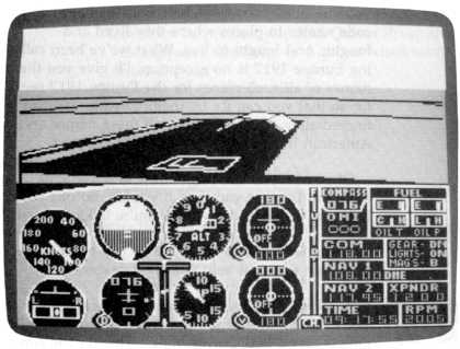
You're looking across runway 33
toward runway 27 at Wigwam. Prepare for
takeoff and taxi ahead, turning onto 27 and accelerating for your
takeoff roll. Use all your rpm and climb straight out on the runway heading until your altimeter reads 1000 feet. Then make a 60- or 70-degree right turn and head north toward the Alps. If you made a good normal takeoff, this should pose no problems. Transition to pattern speed, straight and level at 2000 feet. Check radar. There should be a good half mile between you and the Bulges on your left. When the last mile marker disappears under your nose, turn right and head due east toward Red Quiver River. Enroute, reduce your power and descend to 1400 feet. When the river just about divides your windshield, turn right heading 150 degrees and adjust if necessary for 1400 MSL. You'll see Eagle Field ahead to your left, and you'll be downwind for runway 33, with a slight crosswind from 270 on final. Enjoy many flights in Red Quiver Valley. It's one of the most realistic and graphically satisfying flying areas the simulator offers. |
Table of Contents | Previous Section | Next Section