40 More Great Flight Simulator Adventures
by Charles Gulick
Thataway
| North Position: 21347 | Rudder: 32767 |
| East Position: 6312 | Ailerons: 32767 |
| Altitude: 279 | Flaps: 0 |
| Pitch: 0 | Elevators: 32767 |
| Bank: 0 | Time: 14:00 |
| Heading: 0 | Season: 4-Fall |
| Airspeed: 0 | Wind: 5 Kts, 345 |
| Throttle: 0 |
| My first and favorite
instructor, Arnold Kufta, at the then
Totowa-Wayne in New Jersey, was an old-timer who had very little
patience with protracted flight planning. He said it was okay to sit
down at a desk with all kinds of slide rules and calculators and charts
and meticulously work out a course "if you're not going to go." But if
you were going to go, he believed, you should get in the airplane and
start off. No further ado. We were standing out in front of the hangar one summer evening, and he looked at me and said, "Which way is Danbury?" Instinctively I pointed sort of at the sky and sort of to the northeast, and said, "That way." "Okay," he answered. "So let's go." The idea was you get in the airplane and take off, and when you get out of the pattern, you turn in the direction you know your destination lies. And then you start doing what you have to do to be accurate. It wasn't that he didn't believe in flight aids. He just believed that the place to use them was in the air and on the way. "If you ever fly for hire," he'd say, "the passengers aren't going to wait while you sit down at a desk and work everything out. They'll find a pilot who's ready to go right away, not an hour from now." |
|
 |
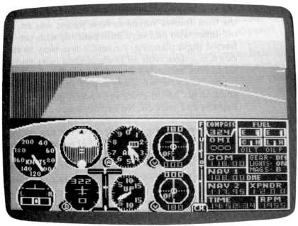
So you're looking through your
windshield at runway 35, Sanderson
Field, Shelton, Washington. And your destination is Harvey Field in
Snohomish, which is sort of in the sky and sort of to the northeast.
Thataway. Let's get going. When you're straight and level at 3500 feet, pointed toward Harvey, look at your Piper version of the Seattle chart (reproduced here and included as part of the appendix, courtesy of SubLogic Corporation, for the benefit of Cessna pilots, whose charts do not show the smaller airports). Eyeball a straight line from Sanderson Field to Harvey Field. Look at the bodies of water along the route and particularly at the airports you can use as checkpoints. They're more reliable than water, especially in the simulator. So now you know what to look for on the ground. Keep a continuing watch out all your windows. Make outside checks as regularly as you make instrument scans. If things don't look right, keep looking until you understand what's wrong with the way they look, then make the corrections your new information calls for. Bank and turn the airplane as necessary to point it where it's supposed to be pointed. Don't start worrying if you feel you're lost. You have a full tank of fuel, clear weather, a chart, and a pair of eyes. You know exactly where you're going. It's a simple matter of looking and thinking. That's called contact flying. The simulator is tougher on this type of flight than is the real world. Some simulator airports, for example, don't show up right away. But then, some airports seem to be awfully difficult to spot from the air in real flying, too. Don't turn to new headings aimlessly. Wait until you have a pretty good idea where you are, and then get where you're supposed to be. Use radar if it helps. Use anything except your NAV system. (You're in a rented airplane that doesn't have one.) After all, you're a bit familiar with this whole area just from flying various modes in this book. Note on the chart how many runways a given airport has, and which way they point, and what if anything they're near, like water. And look out your windows! When you get over Puget Sound, note that you can consider Harvey Field's location with reference to at least three other airports: Snohomish County, Martha Lake, and Flying F Ranch. And note how useful (particularly if you're flying the Cessna) the FAA sectional charts would be when you're flying the simulator. They show, of course, more detail than even the Piper charts. Snohomish, being a major (favored) airport in the simulation, will be the most prominent in both your radar and out-the-windshield views. So if you find you aren't flying straight arrow to your destination, you'll still get there much faster than by doing all that desk work Arnold used to argue against. And certainly, if you were to use your radio stack, you could have picked up your heading after you got airborne, using Paine VOR (given that, if flying the sparse Cessna charts, you knew where Harvey Field was). Coming near your destination, don't fail to note that little finger of water pointing up to Snohomish. Its name is Washington Lake, and we flew down it a few modes back, checking on the fabled floating bridges. Remember? Its purpose here is to help you point at Harvey Field. The runway at Harvey bears 14/32. So remembering the wind, you'll know which end is active. Isn't this an exciting and challenging way to fly? |
Table of Contents | Previous Section | Next Section