40 More Great Flight Simulator Adventures
by Charles Gulick
Splendor in
the Grass
The Manhattan Project I
the Grass
The Manhattan Project I
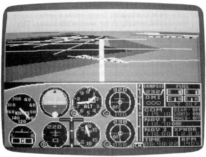
| North Position: 17065 | Rudder: 32767 |
| East Position: 20996 | Ailerons: 32767 |
| Altitude: 23 | Flaps: 0 |
| Pitch: 0 | Elevators: 32767 |
| Bank: 0 | Time: 6:30 |
| Heading: 220 | Season: 2-Spring |
| Airspeed: 0 | Wind: 4 Kts, 220 |
| Throttle: 0 |
| It cost me a cool $45 million to
buy the property you're sitting on.
Just to create a perfect airport for you, virtually in the heart of
Manhattan. This beautiful grass area, all yours, will make you the envy
of every pilot in the world. In all seriousness, this is a most
desirable, picturesque, and exciting private flying field for you. Give
it a name, maybe your own name, or perhaps your initials, and ink it in
on your chart after you understand exactly where it is. The general
landing and takeoff headings (a grass field doesn't really involve
specific runways) are 40 and 220 degrees. Elevation of the field is 23
feet. Now let's get acquainted with it, on the ground and in the air. |
|
 |
Go into radar and zoom to the
high altitude view that shows you an
airport, far off to your left. That's John F. Kennedy International.
Tune Kennedy VORTAC, 115.9, and your DME will tell you exactly how far
you are from the airport. It's about 11.5 miles, but the exact distance
varies with different computers. The highway pointing to JFK is
Interstate 678, locally known as the Van Wyck Expressway. It crosses
the East River as the BronxWhitestone Bridge, the nearer of the two
bridges at about seven o'clock your position. The bridge east of that
is the Throgs Neck. (A throg is
a neutered frog.) You can see that you're at almost the southern tip of Manhattan, with the East River to your left, Upper Bay and eventually the Atlantic Ocean directly ahead of you, and the Hudson River across Manhattan Island to your right. Zoom in two notches, and three bridges crossing the East River become distinct, as do some Manhattan streets. The bridge far behind you is the Queensboro Bridge, so-called because it connects the boroughs of Queens and Manhattan. Under it, invisible in the simulation, is Roosevelt Island. The bridge continues as East 60th Street for about six blocks, where it runs right into Central Park. The first bridge ahead of you is Williamsburg Bridge. It continues as Delancey Street in downtown Manhattan and joins up with the Holland Tunnel under the Hudson River. The farther bridge, and a superb threedimensional feature of the simulator, is Manhattan Bridge, connecting Brooklyn to the Lower East Side of New York City. Before it becomes a bridge, it's Flatbush Avenue, Brooklyn, famed in story and song. On the Manhattan side, it's Canal Street, which crosses to Holland Tunnel. The southern tip of Manhattan is known as the Battery. In order of their adjacency to you, the three avenues running down the island are FDR (Franklin Delano Roosevelt) Drive, Fifth Avenue, and Broadway, the latter two bordering Central Park. The crosstown streets are, to the north of (behind! behind!) you, 42nd Street, and to the immediate right of your position, well, I can't figure out what it's supposed to be, so let's call it-at least that portion of it this side of FDR Drive-Edge Road. That'll be useful, because Edge Road points to the northern boundary of your airport, and you can use it as a landmark. However, a more important indicator of the edge of the airport is the distinct bend the paved metro area takes at this point. |
|
Exit radar and look around. Out
front, crossing the East River, is
Manhattan Bridge, a great sight to take off over (and I'm as anxious as
you are). Out the right front you can see the World Trade Center towers
at Fulton Street and Avenue of the Americas. They're 110 floors high.
Just visible to the left of the towers is the Statue of Liberty. Out
the right rear you have a fine view of the Empire State Building at the
corner of 34th Street and Fifth Avenue. Out the rear you see just a bit
more of the East River, giving you a better feel for your airport. And
all the left side views show you the relationship of your airport to
the river. Isn't it nice? If you happen to run into someone who's afraid to fly with you, all you have to do is sit them in the airplane and take out-the-window views. They can see every feature of the New York City simulation without leaving the ground. |
  |
Enough familiarization. Let's
view your private airport from the air.
(You may want to follow this flight through several times to take all
the views and note all the things suggested. Take pauses as frequently
as you like.) You're pointed in the right direction. Use ten degrees of flaps, set your trim, and make your normal takeoff. Note that the (black) metropolitan area comes into view almost as soon as you're airborne. Once you've dumped your flaps, start reducing your power to medium slow-fly the airplane (Cessna at 1605, Piper at 1650 rpm), and trim for straight and level at about 1000 feet. What a great view of the Manhattan Bridge you have! After you pass over the bridge (take a down view to see it pass under you), take a direct rear view of your airport, and watch until most of the bridge is visible. Then pause. What a perfect scenic. It's about what you'll be looking at when you're on final approach in the opposite direction-heading about 40 degrees. Visualize yourself lining your nose up with the far point of the triangle, but landing just beyond the near side. That's the Williamsburg Bridge, which you'll overfly on final when landing to the north, crossing the East River just beyond the Manhattan Bridge. And you can also see La Guardia back there beyond Queensboro Bridge. All kinds of references. In all humility, isn't this spectacular? |
|
Unpause and let's fly an
extended pattern to take in the whole area. Restore your out-front view and turn crosswind (left to a 130-degree heading). You'll see JFK on the horizon when you roll out. You could be inbound for runway 13R. Take a left rear view, and when Manhattan Bridge is about at the center of the scene, return to a front view and turn downwind (crosswind minus 90, remember, or the reciprocal of the takeoff heading). La Guardia is approximately ahead, but notice you're not in conflict with its runways. |
|
Take a radar view so you can get
used to spotting your airport that
way. In one of a couple of possible views, you'll see Manhattan Bridge
as the southernmost of the three key bridges. It crosses the channel
(Buttermilk Channel, it's called) at an angle, as compared to the
Williamsburg Bridge just above it. And above the Williamsburg Bridge is
the green strip that represents the $45 million property I've bestowed
on you. Observe the green strip on radar carefully. Remember that the actual airport lies between Edge Road, or the spot where the Manhattan metropolitan area angles out toward the East River, and the sharp point where the green strip meets Manhattan and the East River. If you land just anywhere on that long stretch of what looks like grass, you'll be likely to bump into all kinds of things and give your new airport a bad reputation. Take various views out the left side as you fly downwind. Notice that the roads leading to the Manhattan and then Williamsburg bridges are clearly visible on the landscape-a help in pinpointing your airport lying north of them. The road you see this side of the Empire State Building is the fabled Edge Road, so you can probably see the whole lie of your airport. If you can't, maybe you flew too long a crosswind leg, so fly it again. (Note that the Empire State Building mysteriously vanishes now and then, often when you're about opposite it. Either that or, being quite old, it's extremely thin from certain perspectives.) |
|
Either now or quite soon, you'll
be able to see the third key bridge,
the Queensboro, and its access highway. As you come up on it, turn left
to a heading of 310. (Don't confuse this with a logical spot for
turning to base leg-that would be shortly after we're opposite Edge
Road. We're flying an extended sightseeing pattern here.) |
|
You can see that the Queensboro
Bridge, whatever your in-flight
relationship to it, gives you another excellent visual reference for
the general lie of your airport. Central Park is ahead of you, and its
southern end, like the bridge, is approximately three miles north of
the field. Look out the left side down the East River toward your airport. We're not going to land this time around. But pause frequently as you fly and try to fix the scenery of the whole area in your mind. Edge Road, where Manhattan juts over toward the river. The Williamsburg and Manhattan bridges below your airport. And a little farther on, the perspectives of the three major buildings and of midtown and lower Manhattan. |
|
When you're opposite the second
of the Trade Center towers, start a
left turn to head 220 degrees, or upwind. The towers should be safely
off to your left. Then look out your left side and note the
now-familiar scenery from this perspective. And Edge Road, and your
field below it. Then the Williamsburg followed by the Manhattan Bridge.
See it all on radar, too. Fly this heading until you're beyond the tip
of Manhattan and out over Lower Bay. Grab a look at Liberty, too, out
the right front and then on radar. When radar shows you're opposite the statue, turn left heading 130 degrees. Look out the left side again. You can still pick out all three key bridges and your airport. Is there a more scenic view in all the simulator world? When the East River is under your wing tip, turn left, fly to the center of the river, and track it on a heading of 40 degrees. If you've lost or gained altitude, get yourself back to 1000. And now observe, off to your right after you overfly Queensboro Bridge, La Guardia Airport. That's where we'll land this morning. No, don't be impatient ... everything in its own time. We'll land at your airport next time. We've only begun the Manhattan Project. I am sure, your memory and/or note-making habits being what they are, that you know which La Guardia runway (of 4/22 and 13/31) is active. And yes, a right-hand pattern is permitted. |
Table of Contents | Previous Section | Next Section