40 More Great Flight Simulator Adventures
by Charles Gulick
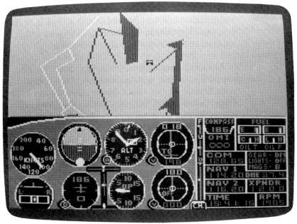
Waterline
| North Position: 21412 | Rudder: 32767 |
| East Position: 6476 | Ailerons: 32767 |
| Altitude: 482 | Flaps: 0 |
| Pitch: 0 | Elevators: 32767 |
| Bank: 0 | Time: 15:00 |
| Heading: 167 | Season: 4-Fall |
| Airspeed: 0 | Cloud Layer 1: 10000,7500 |
| Throttle: 0 | Wind: 0 Kts, 0 |
 |
While you're waiting for takeoff
here at Bremerton National, switch in
your radar and adjust it until you see four chunks of water and, to
your left, most of the metropolitan area of Seattle. Ahead of you is Henderson Bay, and the little pencil line at two o'clock leads to Hood Canal, with Dabob Bay at about five o'clock. Much of the Puget Sound area, between where you are and where Seattle is, is reduced to thin pencil lines in this graphic. But just to your left is an unseen little sluiceway where there's a navy shipyard and museum, and the WWII battleship U.S.S. Missouri is on display. The Japanese formally surrendered on "Mighty Mo" in 1945, ending the Second World War. You have no weather report, and there's no tower. What you do know is that there was a breeze hitting your face before you climbed in the airplane, and that it was coming from the south. So we'll take off on runway 19. Then we'll follow the little water line over on the right to Hood Canal. We'll track the canal north to Dabob Bay. |
 |
Go through your pretakeoff
procedure, taxi into position, and hold for a moment while you read the
following. We'll climb straight out and plan to level off and get into slow flight at an altitude of 1500 feet. As you climb, then, pay attention to your altitude. Take a right front view and look for the little pencil line that leads to Hood Canal. You'll be able to see it while runway 19 is still beneath you. Turn and line up with this strip of water and slowly fly along it at your altitude of 1500. Use radar, if you like, to help you do this. Go ahead and roll. Once you have the thin waterway on a straight line ahead of you, you'll see that it bears about 225 degrees. Hood Canal is the good-sized body of water at the end of this line. Just about where the pencil line starts is the town of Belfair and a state park of the same name. Five miles or so farther along is Twanoh State Park on your left. |
 |
Once you have the canal clearly
visible, fly a bit to the left and pick
it up where it starts. Use your right side views to see the perspective
of the water and judge your turn. Use radar if it helps. Note how the
little pencil line of water connects into the big picture. On the north
shore, just about at that point, is the town of Tahuya, and on the
south shore is Union. Below your aircraft as you turn to track the
canal are Snohomish Indian Reservation and Potlatch State Park. |
|
After you're settled on the
canal heading (about 12 degrees), take a
view off to your right. That's Mount Rainier, a good 60 miles away.
Look directly behind you, too. Pretty piece of water, isn't it? Two
other little towns you'll pass are, in order, Hoodsport and Lilliwaup.
Don't you love some of these names? The canal is so straight you might want to vary your flight a bit, lining up with and flying along the east and/or west banks for a while. You can't see U.S. 101 in the simulation, but it parallels the west bank. The highways visible way over there around Seattle are Interstate 5 and Interstate 405. When you're about three-quarters of the way to Dabob Bay, you'll be able to spot Bremerton National off your right wing tip. But what happened to Mount Rainier? It's a cloudy day, sure, but it isn't that cloudy, is it? They give you a runway and take away your mountain. As you near the bay, the geography off to your left is Dosewallips State Park, part of the Olympic National Forest. The forest stretches all the way from here almost to the northern border of the state. There are spruce trees and Douglas firs in there high as 25-story buildings. |
|
Getting close to Dabob
Bay, you'll see another pencil line of water
splitting off from it, just to the right of where the land juts
forward. That's more of Hood Canal, and we'll fly over there and follow
it. As you make your turn, you'll be passing Scenic Beat State Park on your right and the little town of Seabeck. |
|
Keep an eye out to your right,
and you may see a mountain magically
materialize on the landscape. Around the same time, someone will dump a
whole lot of landfill into Dabob Bay. But follow the canal line anyway. It's not the one that veers off to the left, but the one ahead, bearing about 5 to 10 degrees. The large body of water up ahead is Admiralty Inlet, part of Puget Sound. And on its southern bank, to the right of the canal, is another Indian reservation, Port Gamble. Those mountains off to your right are part of the Cascade Range, far to the east. |
|
The canal will shift around a
bit, but just keep the point where it
joins Admiralty Inlet ahead of you. As you get beyond that point, go
into radar mode and you'll pick up an airport to your right. That's
Snohomish County. Paine VOR is right there, so tune your NAV to it-114.2. Center the OBI needle and take up the heading you read out. Contact Snohomish ATIS, 128.65, to check weather and which way they're landing. (They tell you zero wind, but you remember that breeze from the south at Bremerton.) Elevation is 603 MSL, so your altitude, if you're still at 1500, is fine for the pattern. And your airspeed, if you're still in slow flight, is fine for pattern airspeed, too. They tell you they're landing on runway 3 (the actual runway heading is closer to 20 degrees than 30 degrees), and there's no traffic, so why not ask permission to enter the left-hand pattern on base leg? That means just an easy right turn to about 100 degrees, followed by a left turn to final when you're ready. If the tower doesn't answer no matter how loud you shout, go ahead and do it anyway. They deserve that for making you land downwind. |
Table of Contents | Previous Section | Next Section