40 More Great Flight Simulator Adventures
by Charles Gulick
Skoal!
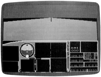
| North Position: 21616 | Rudder: 32767 |
| East Position: 6737 | Ailerons: 32767 |
| Altitude: 137 | Flaps: 0 |
| Pitch: 0 | Elevators: 32767 |
| Bank: 0 | Time: 5:00 |
| Heading: 340 | Season: 3-Summer |
| Airspeed: 0 | Wind: 5 Kts, 340 |
| Throttle: 0 | |
Add for this mode: Wind Level 1: 25 Kts, 180 Shear Zone Altitude 1: 3000 |
|
| This is Arlington Municipal
Airport, Arlington, Washington, a town of
33,000-odd souls some 30-odd miles from the border of British Columbia.
Most important, it's the northernmost airport in the simulator world. Which is lucky, because we want to be as close to where we're going as possible. And we're going north. Indeed, before we take off, I suggest you get yourself a pair of gloves, some earmuffs, and heavy clothing. Not to mention a gallon vacuum jug of hot coffee. Because we're going to take off and fly to-or at least toward-believe it or not, the North Pole. "Baloney!" you say. That's no way to talk. Have I ever let you down before? Is there anything that says we can't do it? Look at it this way. Well, no, we'll look at it that way later. We'll have plenty of time for chitchat since we have a long way to go. |
|
 |
Let's go ahead and get started
while it's nice and early. Notice we
have a nice, gentle headwind for takeoff-right down the runway. Then
above 3000 feet, we pick up a 25-knots-per-hour tailwind, which will
make our flight much shorter. Trust me. Roll 'em. Take off, turn to a due north heading as you pass through 500 feet, and level off at 4000. From that altitude we should be able to see pretty well in all directions. And can't you imagine how scenic this flight will be? I'll pick up the conversation as soon as you have 4000 feet and your heading. |
 |
Look at it this way. (Don't
bother to pause, because this flight may be
a long one. You can read this, and perhaps the last three weeks of the Wall Street Journal,
while you fly.) As I said, look at it this
way-you're at 4000 feet, on a heading of 000, in a 100 percent reliable
airplane. You have a head start on the daylight and a lot of time to
think. You're heading into the Great Unknown. Like Admiral Byrd,
Lindbergh, or Amelia Earhart. You're doing this in a Great Cause, a
Heroic Cause. You're flying into the Great Unknown for the same reason
that Hillary climbed that mountain-because it's there. Now that should be reason enough for any redblooded American. You could be about to make history. Or, at the least, you're meeting a great challenge, doing a great deed of derring-do. But wait, there's more. |
|
First, though, let's make our
last contact with simulator civilization.
You're somewhere east of the northernmost VOR station on your
charts-Bay
View. Set your NAV to 108.2 and see how far away it is. It'll keep
getting farther away. But at least it'll give us something that's alive
on the radio for a while. We know there's no North Pole in the simulator world. We're not kidding ourselves. We're not going to see a lot of ice and snow or any little flags down there even if we fly all day and all night. But one thing is virtually certain. We'll see something. And unless we take this flight, we'll never know what, will we? So all your friends who've never flown more than ten miles from Meigs will wind up envying you. All those armchair pilots without the Right Stuff. If we can fly to the moon in a spacecraft, we can certainly fly to the North Pole in this simulator. And something else. It stands to reason that the simulator world doesn't actually end. If it did, what would happen? Would the computer shut itself off? Would we get a disclaimer of some kind on the screen? Something like, Sorry, but you can't get there from here. Would the plane stop dead in its tracks and fall out of the sky? This isn't a movie, it's a simulation of real geography. There can't be a specific end, any more than space can suddenly stop. What is the simulator world? A big sphere? If that's so, then we're on the outside of it, or the inside of it. Either case, it curves back on itself, and we'll get to the southernmost extremities by flying to the northernmost. It shouldn't even take too long. If it's flat, like a big sheet of paper, then the same thing will result, except we'll fly off the top and fly in again on the bottom. If it's a Möbius strip, same thing. Or what if it's a piece of paper printed on both sides, with, say, Seattle on one side and New York/Boston on the other? Maybe we'll fly from Arlington Municipal to JFK in an hour or so. Faster than a speeding bullet. Very green out there, isn't it, if you have daylight by now. And we've put some distance between us and Bay View. My DME reads 77.1 right now (just so we'll have at least one last thing to compare as we fly). But don't be a quitter. This could be the most important flight you'll ever make. Check your altitude once in a while. Stay at 4000 and keep your heading. Look around once in a while. The populated area we've left is still visible out the back at 83 miles from Bay View. I have a hunch something-I don't know what-may happen when that little strip of something disappears. I know you're looking at nothing but green, and it gets pretty boring. But the Lone Eagle looked at nothing but blue for many long hours. And he couldn't even see out the front. DME's still reading out, at-oops, it isn't any more. Think it was 89 something. So now we're at a plateau of some kind. I can't tell you where I am. But we still have a reference-old Father Time. My time right now is 5:50. I still have that strip of world behind me and nothing ahead of me. Want to send out for a sandwich? We certainly can't take our eyes off the screen, with all the excitement going on there. Time-5:52. And the strip is still visible out the rear. We've not slipped the bonds of Artwick yet! At 5:53:22, I'm looking out the rear, and, peculiar though it is, the thin strip of civilization is at the top of the horizon. It has nowhere to go now but up, into the sky, in other words, out of the simulation. When you get near that time, keep looking out back and see what happens. But now, as I'm getting back up to 4000, the altitude gives me a higher perspective, and the strip is a hair below the horizon. So whatever's going to happen isn't going to happen just yet. Now I'm level at 4000, the time is 5:58, and the strip is about its own width under the rear horizon. It's about a half inch off the left of my fin, just sitting there. Now it's exactly even with the horizon, at 5:58:31. Something's bound to happen now. Except it doesn't seem to know exactly where it is, because it slips back into the world by a hair again. Anyway, its time is definitely short. Watch with me. And when it pops off, be ready to take an immediate look out front and see if anything pops on. At 6:14, by my clock, the strip popped into oblivion. And I take a quick look out front. And I see something. Lots of green. Left and right front views, too. Green. I remember that "Sesame Street" song, "It Isn't Easy Being Green." It isn't easy looking at it either. But fly on. We've only been out an hour by my clock. Your clock, of course, may be slightly different, depending on how you took off and got to your heading. I'll keep looking out both sides now at regular intervals. Wondering when I'll get to the edge of the piece of paper. Of course, there's a possibility that we could actually be flying on the other side, or into the opposite edge, of the piece of paper, or crossing a seam in the sphere, and still see nothing because we're there, but we're not near anywhere. If you follow my meaning. I think I'll get out my Los Angeles chart and see if I can raise any OMNI stations down there. Let's see. Southernmost is Mission Bay, 117.8. Tune to that. Nothing? Let's try Santa Catalina, 111.4. Well, we're not 80-85 miles from either of them. What else have we? Nothing in the Los Angeles area. So let's move east and try the Chicago area. Get out another chart. Champaign VORTAC, 110.0. Nothing. One more possibility. New York/Boston. VORTAC Kennedy, 115.9. No such luck. Try Martha's Vineyard, though I have no idea why, 108.2. Well, maybe we can try tuning OMNIs at the top of those areas. Nothing says we have to come in at their southern extremities. I'll try one, anyway. Back to-well, it wouldn't be Seattle, would it? So try top of Los Angeles? That doesn't make any sense. Anyway, Fillmore, 112.5. Kind of dead out here, isn't it? Once in a while, anyway, I'm going to try to raise Mission Bay. Really a world apart out here. Why bother to put all this nothing geography in this thing? You could put ten thousand Ringling Bros. and Barnum & Bailey Circuses out there. And still have room for Asia. My time is your time. I mean mine is 6:21. These songs keep going through my head. Nothing out front. Nothing out left side. Nothing out right side. Nothing down. I hope you're not beginning to think I've led you on a wild-goose chase. You enjoy flying, don't you? If not, why did you invest all that money for a computer to fly this simulator? So you're flying. So enjoy. Time is 6:26. We haven't even been out an hour and a half. I'm beginning to wonder whether that due north heading made any sense. My geography isn't all that great. And maybe, even if this simulator world is all on a piece of paper, our great circle route has got us into Idaho or some place like that. And we could keep flying in great circles all around the globe for three or four days, just missing exciting places by a few hundred miles. I wonder what North Position and East Position readings are right now. With a little clever research, that could give us a clue as to where we are in a general way. But that would be cheating. Admiral Byrd didn't have an editor he could check with. Or Lindbergh either. It's 6:32:14, and I'm still tuned to Mission Bay. Come to think of it, that's Lindbergh's own namesake, San Diego International-Lindbergh Field. But a lot of help that is now. Nothing out front, nothing out right, nothing out left, nothing out anywhere. I wish you'd make some conversation. I mean, you just sit there. Like this was all my fault. I didn't design the simulator. Or the world, either. Go ahead and quit if you want to. Go ahead, go back to your cozy Meigs field and practice crashing. See if I care. If Eli Whitney had quit, we wouldn't have the cotton gin. I would never have suggested we try to fly, say, from New York to Los Angeles, over the regular airline routes anyway. But this idea of flying off one edge and onto another seemed reasonable to me. Or flying around and upside down from one place inside a globe to another place on the other side of the globe. One thing is sure-if you throw in the towel, you'll never be able to discover what the rest of us are going to discover on this flight. Because I don't intend to reveal the coordinates of our destination when we discover it. If you're really dying to see something-anything-take a look straight down. If you're flying a Cessna, that's your wheel. And if you're flying a Piper, you tell me what it is. And while you're looking at it, I'll tip you off to a real fun thing if you're flying Cessna. Retract your wheels. Just for a second. And then put them down again. Wasn't that fun? That alone could make this whole trip worthwhile. (If you're in Piper, I don't know what to tell you to do.) It's 6:51:01 (or just was) by my clock. I'm going to try tuning Bloomington VOR, 108.2. Don't ask me why. And don't bother doing it. I chose flying north because I figured that would be a shorter distance around than flying east or west. And I chose not to slew for a number of reasons, not the least of which is that I subscribe to the realism of the simulator. It's coming up on 7:00 a.m. At that time, we'll have been flying two hours. I'm tuning the NAV back to Mission Bay, 117.8 (if one could be said to be "tuning" anything out here). But I think we're way east of San Diego. Not to mention north of it. I wonder how long it would take to try to raise every OMNI station there is. There must be some kind of solution to this thing. It's about 7:07. And by my best estimate we're now over the Galapagos Islands. The Galapagos Islands are an island group with an area of 2966 square miles. Situated in the Pacific Ocean, 650 miles west of the mainland, the islands have a population of 2400. That's more than one square mile per person-man, woman, and child. Starting with 108.0 and advancing slowly by 0.05's, I can tune through the entire NAV frequency spectrum. Slowly, and see if anything at all comes alive. No, I didn't suggest you do this. I have no control over your behavior. But I assure you, if I do find something, I won't spoon-feed the numbers to you. Anyway, do you have a better idea? Well, it doesn't take as long as you might think to exhaust the OMNI possibilities. And since you haven't made any wisecracks for quite a while, I do feel obligated to tell you something. That something is-we're not within 85 or 90 miles of anywhere at all, if you want to believe the OMNI. We're nowhere-we won't see a landmark, let alone recognize it, for a long, long time. It's now 7:36:31, and as far as I'm concerned, we made it. I'm perfectly aware that you might not recognize that fact, but just bear with me, and follow my instructions exactly. |
|
Reduce your power to set up a
descent rate of 500 feet per minute.
Don't mess around with your elevator. Leave it where it was when you
were straight and level (for the last two and a half hours). And don't
make any additional rpm adjustments. At lower altitudes, your rate of
descent will slowly diminish by itself. Just let the plane descend of its own accord. We're going to make an airline approach and landing, nice and flat. We want the airspeed we have, because it's very icy down there. Higher airspeed will give us better control on the ice. We don't want to be sliding all over the place, do we? If you should get to where you're descending at lower than 50 feet per minute, of course, take off a notch of rpm. We don't want to come in that flat. But if you're descending at all, keep it that way. The plane will land itself. And the landing alone will make aviation history. We will get a special certificate from the Federal Aviation Administration, commemorating the longest final approach ever flown in a single-engine aircraft. Not to mention we'll be in the Guinness Book of Records. When your VSI goes to zero, you'll know you're on the ground. Cut your power, but don't use brakes. Let the airplane slide to a stop on its own. Never made a smoother landing, did you? No bounce. No wild oscillations. Look around you. If you're flying a Cessna, there may be a funny something about your wings. Without your being aware of it, I've carefully tricked you into flying to the one place you never believed we'd actually reach. Where I jokingly said, way back at the beginning, that we obviously couldn't actually get to. But we made it. Plus or minus no more than 187 feet in any direction (depending upon minor differences in our on-board clocks as compared to Greenwich mean and other times, and on how closely your flight duplicated the one described), you're sitting on, and looking at, none other than the North Pole! I appreciate that you're probably feeling cold up here, and the cold is creeping into the cockpit. But against that cold, may I offer you my sincerest, most heartfelt, and very, very warmest-congratulations! |
Table of Contents | Previous Section | Next Section